

The Jerma River (Sukovska River) is a left tributary of the Nišava River with a total length of 72 km. It springs east of Vlasina Lake, where its source arm is the Wolf River. After 17 km, it crosses into the Znepolje region of Bulgaria (also known as the Thorn River), then flows through the Bulgarian territory for 27 km, then returns to Serbia near the village of Petachinci in the Dimitrovgrad municipality and flows mainly north for about 28 km to the catchment area. in Nisava near the village of Sukova (11 km from Dimitrovgrad).
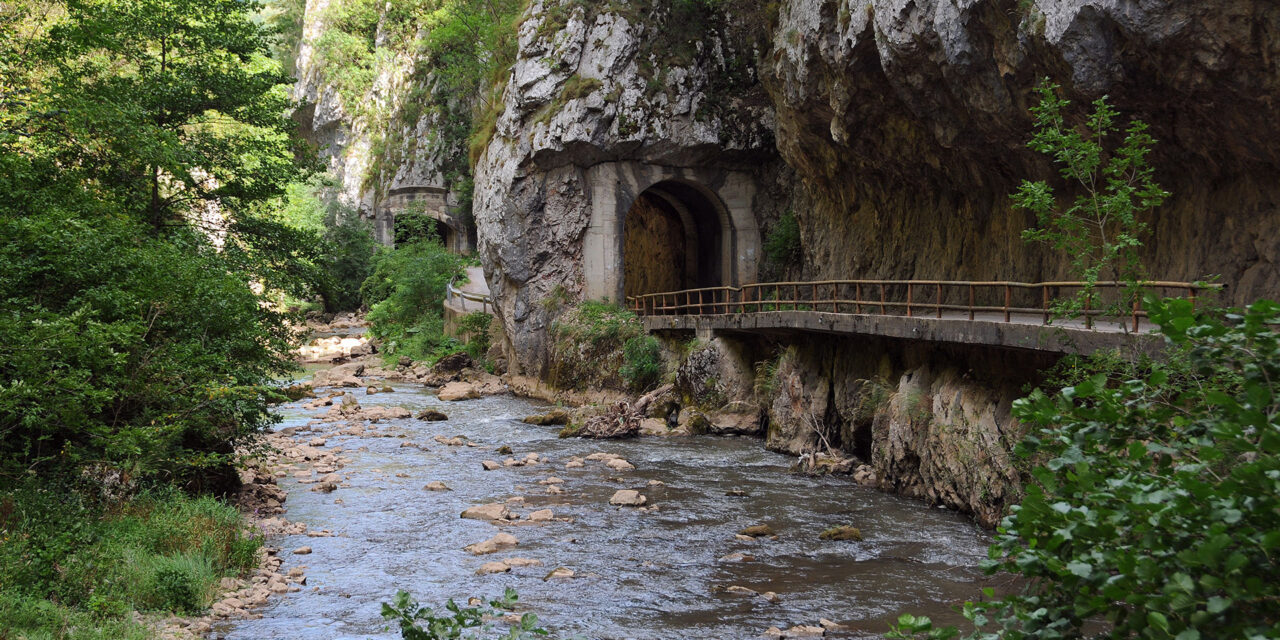
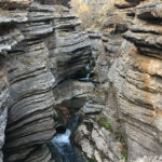
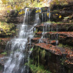
The Jerma River Gorge was formed during the Tertiary after the regression of the Seine Sea (about 65 million years ago) and the complex long-lasting changes in the initial paleolief. The formation of today’s visor occurred in the post-Lake Pliocene-Pleistocene phase as a result of the combined effect of tectonic activities, water erosion, denudation and karst processes. That’s when the Jerma River came into being. In the Derekula region, the bed of the Jerma is wide in extension and very narrow in the gorge . The water flows through the gorge with a strong noise, breaks past huge blocks or is crushed, swirled and foamed from them. In the wider part of the river bed, the depth of clear water in the summer is several tens of centimeters, and in the gorge at least about two meters.
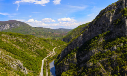
During periods of snow and heavy rainfall, the water level is much higher. Making its way through the Reef Mountain (1,337 m) and Vlaska Mountain (1,442 m), Jerma builds two huge gorges called by the locals Odorovsko and Vlasko Gorge, with sides 300-400 m high and 10-30 m wide. The ravines were completely impassable until 1927. Then, for the needs of the coal mine “Rakita”, a narrow track was cut through the gorge. The mine was closed in the 1960s, and in the 1970s an asphalt road was made instead of the railway.

Incredible nature. Must see and walkthrough. Also, visit two beautiful monasteries in the Jerma Gorge in the villages of Sukovo and Poganovo. At the moment when we have visited it, the access road was under construction, but soon it will be easily accessible. In the village of Sukovo, ask for Jelena, organizer of Jerma Outdoor Festival to be your guide.